SUP – Loch Awe – 2015
Loch Awe, Argyll and Bute, Scotland.
December 2015
Determined not to be stopped by Storm Desmond, Rhona drove the X-bus, (X-bus for eXpedition bus, or eXtreme bus, or simply because our wee camper used to be a bus), through the pouring rain, and along roads that were shortly to be closed due to flooding. Desmond was not going to get in the way of our holiday!
We were off to Argyll chalets near Port Sonachan, on the shores of Loch Awe. At over 40km long, Loch Awe is the longest freshwater loch/lake in the UK, and I was hoping to SUP the full length.
SUPing 40km may not sound that special, but I am registered blind, and I was aiming to do it without a sighted guide. What could possibly go wrong?
The weather forecast, (which was only received when Rhona and Stumpy ran to the top of a nearby hill and pointed her phone to the heavens), said that Tuesday the 8th of December was going to be the best day to attempt the paddle. There was a weather warning from 5pm on the Monday, through to 7am on the Tuesday. There would then be a patch of good weather, before sleet and snow was predicted to arrive around 1pm, and a new weather warning would be in place around 3pm that day. Every other day was just going to be wet and stormy.
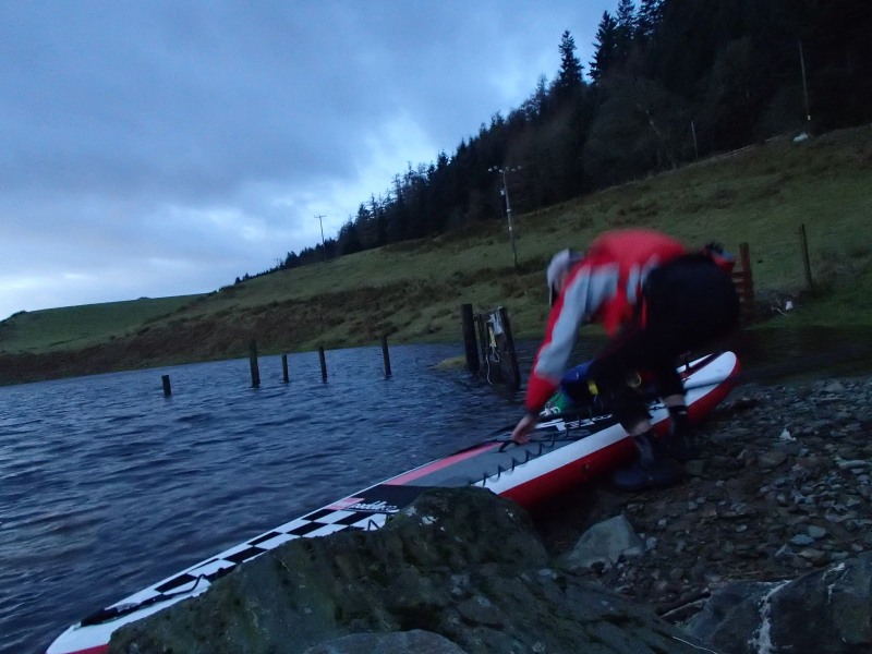 On the Sunday we took a wee drive down to Torran Bay, to see where I would be launching from. The small jetty was hidden under the water, due to the recent flooding, as was a nearby barbed wire fence, (not good for my inflatable 12 6 Red Paddle Race board).
On the Monday Rhona and I got out for a 30 minute paddle, and this was long enough for me to work out how the immediate area around our chalet looked from the water, including a white sticky up thing, (the mast of a moored boat), and a massive white blob just above head height, (the Port Sonachan Hotel). These would hopefully be obvious visual reference points along the way. (Unfortunately there turned out to be lots of white blobs, so it wasn’t as helpful as I’d hoped.)
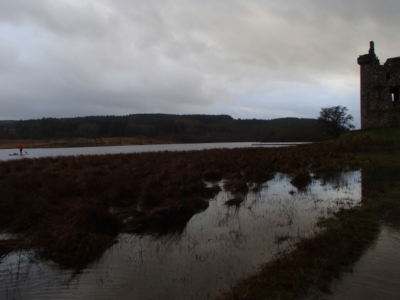
Rhona had also told me that there was an island with a castle on it, and that this was approximately 10km from our chalet, so this could be another reference point if I could find it.
On Tuesday morning we were up at 6am and on the road by 7. Taking our time due to it still being pitch black, and the numerous deer crossing the road, we eventually got down to Torran Bay just after 8am.
After 10 minutes of getting kit sorted, and Rhona telling me which direction to go, I was off. In the dark, I managed to paddle into several marker buoys en route to the beginning of Loch Awe.
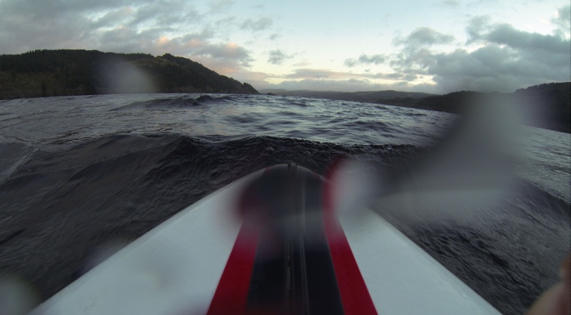
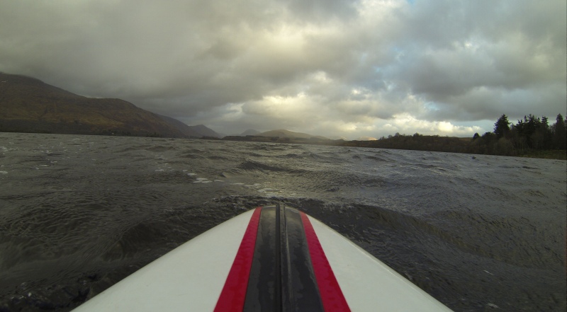
As soon as I left the shelter of Torran Bay, the wind was trying to blow me on to the west shore. However, I had planned to paddle up the east, so spent the first 1½ hours paddling on my left side only. (The previous 2 days, and the following 2 days forecast was for 40+mph winds, but on this day it was just under 20.) I was not going to get across the loch in a straight line, so settled for a ferry glide to my 1 o’clock.
As well as the wind and the waves it created, I had to try to sus out where I was going. When I paddle up lochs, I tend to use my “sweet spot” system.
Due to my sight, when I paddle on lochs I tend to only see 3 layers, (as opposed to trees, fields, houses, etc.). The top layer is white, and is the sky. The next layer down is black, and is the mountains either side of me. The bottom layer is white again, and this is the loch. I like to think of the middle layer as a pair of legs. They are wide, and high, either side of me, but as I look off into the distance they thin out, until they meet in the middle. This meeting point is usually, (but not always), where the loch ends. This is my target, and I call this my “sweet spot”.
For the next 40km, all I would be thinking about was hitting that sweet spot.
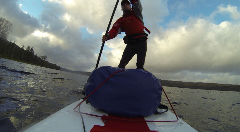
Normally when I paddle on a loch, I don’t wear a PFD, and travel with a small deck bag, with only the essentials. As this was a bigger solo paddle, I went big on the kit, carrying lots of spare neoprene, dry clothes, bivvy bag, and plenty of food.
 My paddles in Perthshire in November had all been done in temperatures between 3 degrees and just below freezing, and meant that I needed to wear my thick canyoning long johns, gloves, etc. Over on Loch Awe, the weather was a tropical 5-7 degrees, so I could go back to my much more comfortable Palm Kaituna ¾ length trousers, and Mistral cag, and no gloves!
During the paddle I passed several islands, which suddenly appeared in front of me, and almost entered several flooded fields.
On one occasion I got very confused. I saw an island appear in front of me, so I decided to pass on its’ east side, but as I did this, I then thought I could see some fence posts sticking out the water on my right. Oh shit, I’ve paddled into a flooded field, and I’d need to back track. However, the wind at this point was so strong, that it was likely to take me over 20 minutes just to go back 100m. Do I go back and knacker myself, or do I explore. “Explore” was my decision.
It turned out that this was an island, and a few minutes later I paddled clear of it. Not being able to see very clearly makes these things happen a lot!
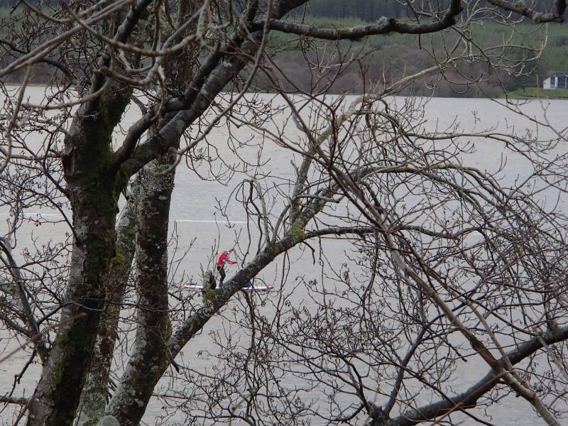
 Although I was on the water on my own, Rhona had devised a plan to watch me from the shore. On our recce on the Sunday, she had located several points along the loch, from where she would be able to see me clearly, and if needed I could paddle in to meet her. We measured these out, and I was able to give Rho a rough ETA on when she should see me pass each point. However, from the water I had no idea where these were, and rarely knew if Rho was watching me. (She did shout encouragement from 3 of these points, and was able to tell me that I was ahead of my planned time, which was a real boost.)
I eventually passed the island with the castle on it, and this was my first landmark. Rho had said this was around 10km from our chalet, so I aimed to get from here to the chalet in under 90 minutes. 70 minutes later I passed the chalet, as Rho cheered me on.
Beyond the chalet I knew that the loch had an arm that went off to the west, and I definitely didn’t want to go down that. However, the wind had picked up, and again I was being blown to the west shore. To add to that, my sweet spot had vanished. Instead of a nice clean V shape at the end of the loch, I just had a very wide, flat patch. I now didn’t know where I was heading.
Several times I thought I was heading north, but in fact had just paddled straight into the east shore. I would then have to look at the waves, and try to work out things from there.
An hour or so later, I heard Rho’s voice shouting from the shore. She told me that I only had about 6km to go. With the current strong winds, that should take me around 40 minutes, so I knew I should start looking for Kilchurn Castle in 30 minutes time.
10 minutes into this last stretch, an almighty hail and sleet storm came in, and pounded me. I did up the Velcro neck of my Palm Mistral cag to stop the sleet running down my neck, but must admit a hood would have been nice at that point! Trying to look for clues, I thought I spotted the castle. It was off to my left, which was where it should be, so hopefully now I should be entering the wee bay next to it.
With the hail and sleet and very strong winds, I arrived at the head of the bay much quicker than I had expected, and instead of a welcoming bay, I was washed into a mass of thorn bushes. (Not good for my inflatable Red Paddle board, nor my arms and legs as I got tangled in it.)
I dismounted from my board and dragged the board through a wee gap. If I was where I thought I was I had done the 40km paddle in just over 5 hours.
In front of me I could see a steep banking. Perfect, I thought. On top of this banking should be the train track, and on the other side of that would be the car park where I was meeting Rho.
As I clambered up the very slippery, leaf- covered banking, and reached the top there was no train track. Bugger, where the hell am I?
Rho and I had a pair of walkie talkie radios with us, to be used in an emergency. The storm was howling, the sky was getting darker, and I didn’t have a clue where I was. I reckoned this could be classed as an emergency. The down side was that these radios are pretty cheap, and only work to a maximum of 3km in a clear line, and 1km through trees.
I grabbed my radio and made a couple of calls for Rho, whilst standing on the banking hoping this 3 metre elevation may work in my favour.
Bingo, we made contact, albeit very crackly. I tried to explain my situation to Rho, but she had trouble hearing me, and I couldn’t really make her out. All she did hear was that I was “lost”.
As we had made contact, I knew we were less than 3km apart. Rho was in the car park near the castle, so I was almost there.

I fought my way back out through the thorns, and tried to paddle back up the loch to get out of the bay. The wind was blowing at well over 20mph, so the only way I could make any headway was to stay kneeling down and lean into the wind.
As I headed up the loch, I decided to check out the big lump that I had thought was the castle. It was only a couple of hundred metres away, but after 10 minutes of paddling towards it, I had only moved a few metres. Bugger it I thought.
My next option was to paddle around the wee headland on my right, and if I was where I thought I was, I should see the railway bridge in a couple of minutes. “Wrong.”
I was back on the main body of Loch Awe, but it looked like I still had a long way to go. Now I was going in the right direction, and the wind was behind me, I called Rho again. This time I told her that I would paddle for 5 minutes and then call her again, and she could tell me if she could see me. (She was now standing next to the castle.)
For the next few minutes, I paddled hard, but in confusion.
The only road I knew of was the Oban road, which should run from my 7 o’clock, down to my 12 o’clock and off into the distance at my 1 o’clock. I could hear that, and that was good, but I could also hear a busy road on my 3 o’clock. Was I paddling in the wrong direction, again? I still had the wind behind me, so I must be going in the right direction, mustn’t I?
I ended up paddling for 10 minutes, whilst trying to work out where the heck I was. Eventually I called Rho on the radio, to tell her that I may be lost again. She told me that she could see me, and that I was only a hundred metres from the castle. She was also able to confirm that there was another road to my 3 o’clock, and that all was fine.
Oh joy, I had done it. A few minutes later I could hear Rho’s voice from the shore, (without the radio), and I paddled down past Kilchurn Castle, and down to the end of the correct bay.
 I’ve been asking around, and it looks like not only am I the first registered blind person to SUP the full length of Loch Awe, but I am probably the first ever stand up paddler to do it!
I have been doing a few talks recently, (see https://dean-talks.com/), and had hoped to rehearse my latest one whilst on this paddle, but every time I took my mind off paddling, I almost went over the edge! Focus was the name of the game.
I had also hoped to improve my non-existent downwind skills, but I’m not sure that happened either.
The paddle had taken me around 6½ hours to complete, and that included almost 1 hour lost in the wrong bay. I know I can do better, so, Loch Awe in 2016 “I’ll be back!”